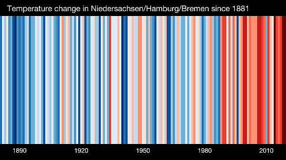
Climate change is measurable: from 1881 to 2022, the annual average air temperature in Bremen and Bremerhaven increased by approx. 1.7°C. It is likely that the average temperature will continue to rise and that extreme temperatures will occur more often in the future. Furthermore, it is likely that the frequency and intensity of extreme precipitation will increase in Bremen and Bremerhaven. In addition, the vegetation periods and thus the phenological seasons are changing: spring, summer and autumn commence already approximately two weeks earlier in the region today than 30 years ago. This trend will most likely continue. Furthermore, the regional sea level is rising, which will lead to higher storm surge water levels and further impacts on the coastal water regime.
Here you will find an overview of the climatic changes in Bremen and Bremerhaven in the past - and their expected future development. This is based on available data for the region, provided by the German Weather Service (DWD) and regional climate projections.

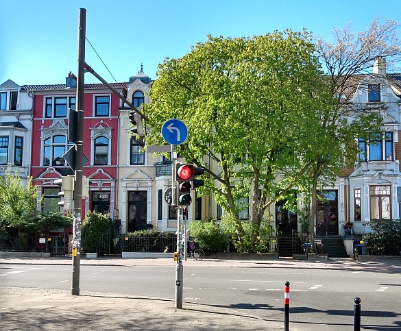
In cities, the so-called "small-scale" and "micro-" climate can change from street to street. Temperatures depend on building height, density of built structures affecting fresh air supply, on shading and green spaces or even the type of surface and their colour. Vulnerability to heavy precipitation and flooding differs depending on elevation, structural features, rainwater infiltration areas, and surface water.
What are the consequences?
One example are heated surfaces during hot summer days. In urban areas where gardens, parks and green spaces can provide cooling effects comparable to rural areas, night-time temperatures will be somewhat lower. In neighbourhoods with dense development and predominantly sealed surfaces however, night-time temperatures will remain at a higher level. Heat is stored in the surrounding area. Cities and heavily built-up areas need to integrate these impacts into their adaptation measures. For the consideration of the bioclimatic situation in urban areas, so-called climate function maps may serve as helpful tools.
Projects
The Projects MultiKlima and BREsilient have touched the topic of urban climate features. To learn more, please visit the page Projects.
Climate Profiles
In 2012 and 2016, the urban climate situation in Bremen and Bremerhaven was captioned. Four measurement rides were conducted, two per each city respectively. See the resulting tour logs below.
Climate Maps
As part of the Landscape Programmes for the two municipalities, two maps have been created, showing the bioclimatic situation in Bremen and Bremerhaven. The maps are available in PDF-format:
Further Information
For further information regarding climate data and GIS, please refer to the page GIS-Information.
The scenarios and models show a clear warming trend for Bremen and Bremerhaven. In a continued business-as-usual scenario, the average regional temperature rise by the end of the 21st century would be 3.6 °C (range 2.5 - 4.9 °C), according to the German Weather Service (DWD).
This is associated with an increase in the number of summer days (Tmax ≥ 25° C), heat days (Tmax ≥ 30 °C) and tropical nights (Tmin ≥ 20° C). In Bremerhaven, this indicates a tripling of summer days in the next 50 years. In Bremen, a mean average of up to nine additional heat days are projected to occur by the end of the century.
The effects of temperature changes vary widely. Especially in the densely built-up inner areas of the two municipalities unshaded, vegetation-poor and sealed surfaces heat up easily (see the section "Urban Climate" above).
The mean annual precipitation totals in Bremen and Bremerhaven have increased slightly in the recent decades - as they have in many regions in Germany. In particular, the volume of precipitation has increased in the winter and autumn months. Future projections show a further slight increase in annual precipitation totals. Seasonally, fall and winter precipitation is assumed to increase. In the summer months, projections vary considerable, with most models calculating a long-term decrease in summer precipitation. However, there are models that also project an increase in summer precipitation.
In any case, the potential precipitation shifts over the seasons and more frequent dry periods will have a noticeable impact on the local water balance in Bremen and Bremerhaven. Therefore, climate change is also expected to have impacts on groundwater levels.

In the second half of the past century, the occurrence of heavy rain days with daily totals larger than or equal to 20 mm has been likely in Bremerhaven than in Bremen. In general, a short-term prediction of the location of the occurrence of heavy rainfall is hardly possible. Trend statements by climate models cannot be conducted to the same extent for individual heavy rainfall events as for extremes of air temperature. However, for the long-term future (2071-2100) an increase in annual precipitation around 10 % is expected. An increase in the number of days with more than 10 mm precipitation per day is likely for the medium and long-term future.
Projects
The Projects KLAS and BREsilient both address measure to reduce the risks associated with heavy precipitation events.
For more information on the projects, please refer to the page Projects.
The Heavy Precipitation Portal
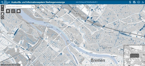
In the KLAS project, the heavy rainfall portal has been developed. It shows those areas in the municipality of Bremen which would be at risk of flooding during heavy rainfall events.
To be forwarded to the Heavy Precipitation Portal, click here

Even though the wind systems above the Northern Sea have not changed substantially so far, climate projections indicate that North Sea storms may become stronger in winter.
Sea level rise is one of the most serious consequences of global warming for the cities of Bremen and Bremerhaven. Towards the end of the 21st century and beyond, sea level rise is likely to accelerate significantly. Depending on the climate change scenarios, sea level rise is projected to range from 45 cm to well over a meter by the end of the century. The interaction of the higher sea level and storm events results in higher storm surge levels.
Projects
The BREsilient project includes the areas of Pauliner Marsch and Im Suhrfelde in the centre of Bremen.
For more information, please visit the page Projects.
The Storm Surge Monitor
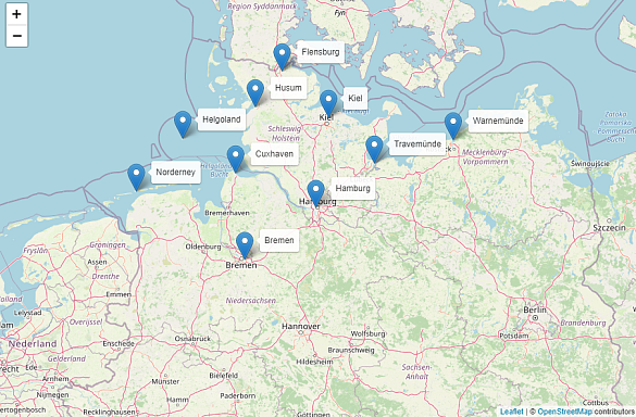
The Storm Surge Monitor developed by the Institute for Coastal Research at the Helmholtz Zentrum Hereon, compares developments of storm surges in the last decades.
To get to the Storm Surge Monitor, please click here